Geography of Spain
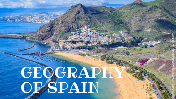
Geography of Spain: From high plateaus to sunny coastlines: Discover how Spain's landscape shapes its climate, rivers, farms, and daily life.
Here are the most important facts about the geography of Spain which were chosen and researched by kids especially for kids in Key Stage 2 and 3.
Geography of Spain
Physical Geography

Let's start with the physical geography of Spain! Here the most important features on these four topics:
Physical Geography of Spain
Location
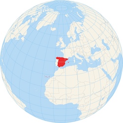 Where is Spain?
Spain is located in the far southwestern corner of Europe on a piece of land called the Iberian Peninsula. It makes up about 82% of that peninsula and shares land borders with Portugal, Andorra, and France. The longest border is shared with Portugal.
The Strait of Gibraltar is just 14.3 km/ 8.9 miles wide at its narrowest point and separates Spain from Morocco in Africa. The most narrow point of the straits is between Point Marroquí in Spain and Point Cires in Morocco. The southernmost point of Spain and the European mainland is Punta de Tarifa.
Did you know?
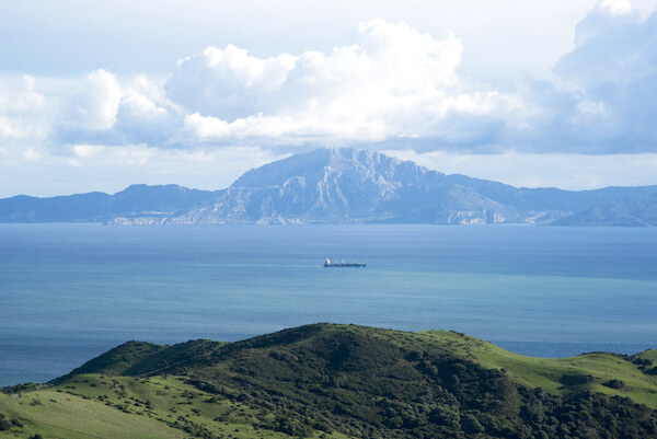 Strait of Gibraltar: Looking from Tarifa/ Spain towards Morocco Strait of Gibraltar: Looking from Tarifa/ Spain towards Morocco |
Spain shares borders with Morocco with the two Spanish enclaves Ceuta and Melilla that are located within the African country.
Spain also has two groups of islands: the Balearic Islands in the Mediterranean Sea (including Mallorca, Menorca, and Ibiza) and the Canary Islands off the north-west coast of Africa, near Morocco.
Geography of Spain
Physical Features of Spain

Now let's explore, how the land is shaped in more detail.
Spain's interior is dominated by a large, flat, higher lying area called the Meseta Central, which means Central Plateau. This massive plateau sits about 660 m/ 2,165 ft above sea level and covers most of the country's interior. Think of it like a giant table with mountains around the edges.
Plateau
The Meseta Central is divided into two parts by a mountain range called Sistema Central (or Central System). This mountain range extends from east to west all across central Spain. The highest mountain of the Sistema Central is the Pico Almanzor with 2,592 m/ 8,501 ft.
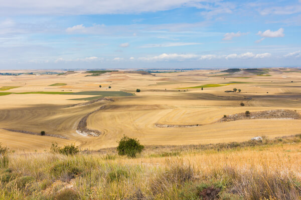 Meseta Central
Important Spanish Words
|
Around the edges of the plateau, several major mountain chains form natural walls.
Mountains
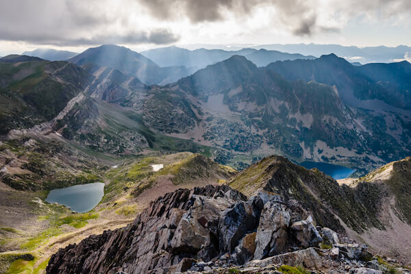 Pyrenees mountains in Spain
Among the most important mountain ranges of Spain are the Central System, the Pyrenees, the Sierra Morena and the Sierra Nevada, which means "Snowy Mountains" in English.
The Central System, also called in Spanish Sistema Central, is the longest mountain range with over 600 km/ 373 miles in length.
The Pyrenees Mountains run along the northeastern part of Spain and form a natural border with France.
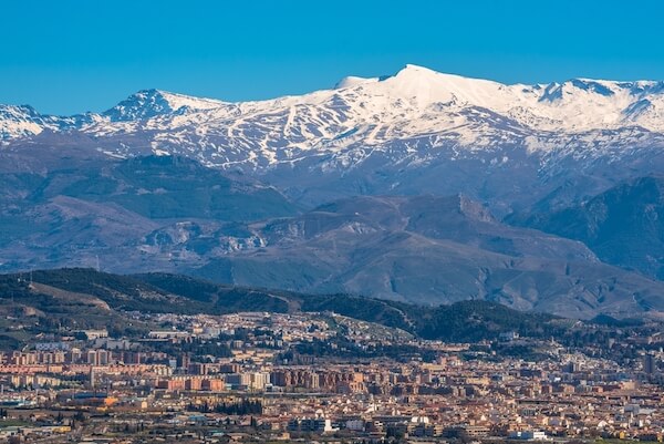 Sierra Nevada near Grenada
The Sierra Nevada is a mountain range in southern Spain. The highest peak of the Spanish mainland is the Pico de Mulhacén with 3,479 m/ 11,414 ft is located there.
The Sierra Morena is mountain range in southern Spain, separating the Meseta Central from Andalusia.
The highest mountain of Spain however is the Teide, a volcano that is located on the Canary Island of Tenerife. Teide mountain is 3,715 m/ 12,188 ft high.
Did you know?
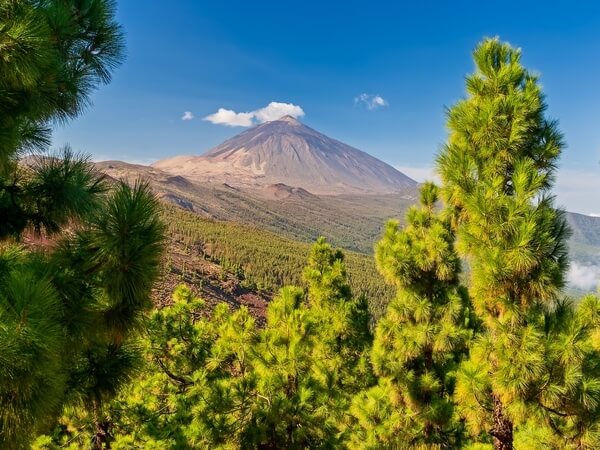 Teide mountain Teide mountain |
Rivers
There is an abundance of rivers in the country as there are about 1,800 rivers in Spain. These provide water for drinking and irrigation for farming. The rivers are also important transport arteries.
The main rivers in Spain are the Tagus (Tajo in Spanish) River, the Duoro River, the Guadiana River the Guadalquivir River and the Ebro River. The Tagus is the longest river of the Iberian peninsula, but is shared with Portugal.
The longest river entirely in Spain is the Ebro with 910 km/ 566 miles. This river flows into the Mediterranean Sea.
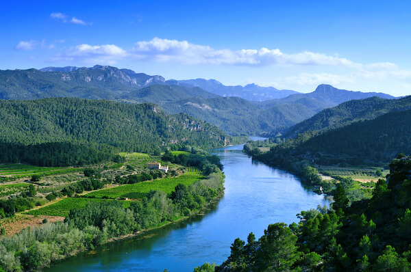 Ebro River flowing through Miravet
The Guadalquivir flows through southern Spain and the Guadalquivir river valley features also many fertile plains.
Valleys
In between the mountains and rolling hills, you'll find valleys and plains that are so important for the country's economy.
Some valleys in Catalonia are filled with vineyards, where grapes are grown to make wine, other valleys have orchards or olive groves.
The Ebro River valley is an important agricultural region producing corn, tomatoes, peppers amongst other fruit and vegetables and the Rioja wine region is also located in the valleys of the Ebro.
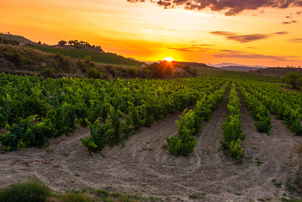 Rioja vineyards
Coastlines
Spain is located along two coastlines and borders the Mediterranean Sea in the South and East and the Atlantic Ocean in the Northwest.
The Mediterranean coastline includes many popular holiday regions like the Costa del Sol (Sunshine Coast), the Costa Dorada (Gold Coast) and Costa Brava (Wild Coast).
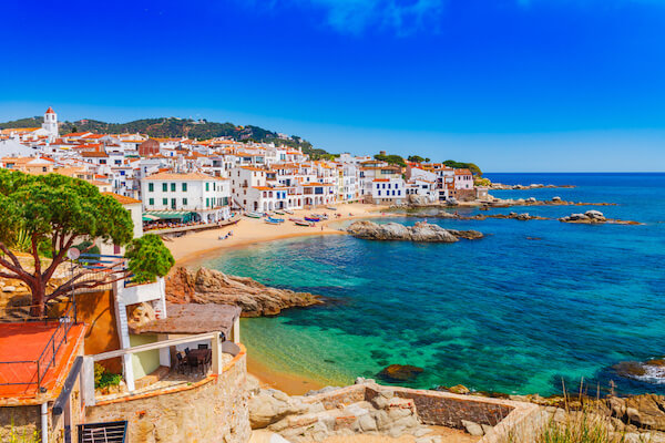 Calella de Palafrugell on the Costa Brava
The northern coastline borders the Atlantic Ocean. The Costa Verde (Green Coast) is in the Asturias province in northern Spain.
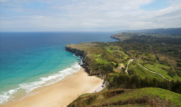 Costa Verde in Asturias
This northern coastline includes regions like Galicia and the Bay of Biscay.
Islands
Spain has 179 islands of which 48 are not inhabited. There are two large archipelagos: the Balearic Islands and the Canary Islands. The Islas Baleares or Balearic Islands are an archipelago of more than 150 islands and islets and are located in the Mediterranean Sea and include the three main islands Mallorca, Menorca and Ibiza. Mallorca is Spain's largest island.
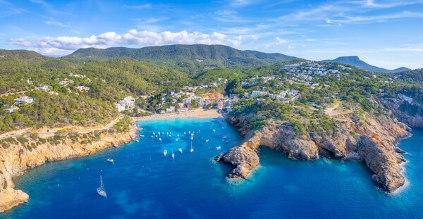 Cala Valdella in Ibiza
The Islas Canares or Canary Islands are situated off the northwest coast of Africa and this archipelago includes eight main islands of which Tenerife, Fuerteventura and Gran Canaria are the largest.
Lakes
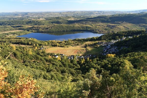 Sanabria Lake
Sanabria Lake in the province of Zamora in northwestern Spain is the largest glacial lake in Europe.
Mar Menor is considered as the largest salt lake in Europe and a coastal lagoon near Cartagena.
Desert
The Desierto de Tabernas or Tabernas Desert in southern Spain is the only true desert in Europe.
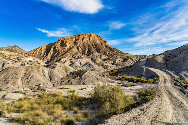 Tabernas desert
The Tabernas desert to the north of Almería has a cold desert climate. Rabbits and hares as well as hedgehogs are among the most common animals in this arid region.
Geography of Spain
Landmarks
Among the most famous natural landmarks of Spain are:
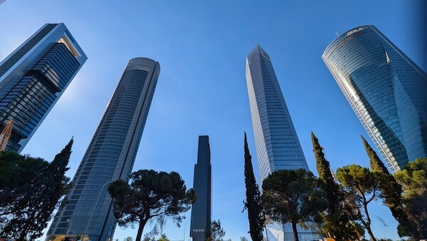 Torre de Cristal Torre de Cristal |
The tallest building in Spain is the Torre de Cristal with 249 m/ 817 ft. It is part of the Cuatros Torres Business Area in Madrid |
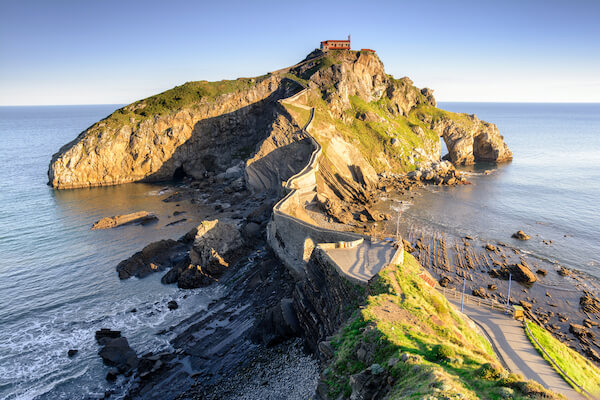 Gaztelugatxe Gaztelugatxe |
The islet of Gaztelugatxe in the Gulf of Biscaye, is featured in the "Game of Throne" movies |
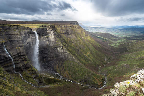 Nervion waterfall Nervion waterfall |
Salto de Nervión or Nervion waterfall with a drop of 200 m/ 728 ft are the highest waterfalls in Spain |
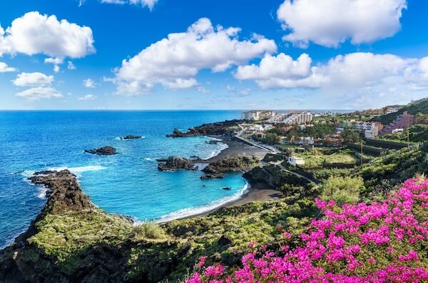 La Palma La Palma |
The black sandy beaches in La Palma on the Canary Islands are made of powdery lava rock |
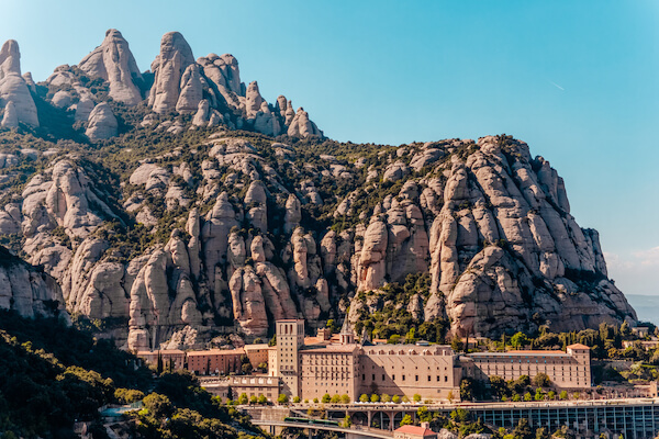 Montserrat Montserrat |
The rugged massif of Montserrat mountain in Catalonia near Barcelona |
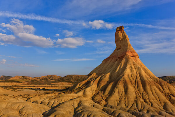 Castildeterra Castildeterra |
The semi-desert landscapes of the Bardenas Reales in northern Spain as seen here in Castildeterra |
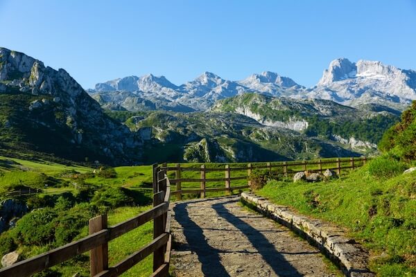 Picos de Europa Picos de Europa |
Picos de Europa is Spain's only inhabited nature reserve. It belongs to the Atlantic ecosystem with oak and beech trees and is home to Iberian wolves and brown bears. |
Geography of Spain
Climate
The climate in Spain varies considerably between the different regions. In the northern mountainous regions the climate is alpine and the interior experiences a hot and arid climate, still most of the country appreciates a temperate and mild climate.
The climate in the southwestern parts is semi-arid while the northwestern parts experiences an oceanic climate. On the Canary islands the climate is subtropical and semi-arid.
Climate change is a pressing issue in Spain that has been affected by higher temperatures, rise in sea levels and low water levels in the country's water reservoirs.
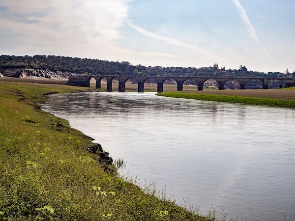 Ricobayo water reservoir
Ricobayo Hydroelectric Power plant is Europe's first large hydroelectric power station and was built already in 1935 and completed in 1999.
74% of the energy sources are to stem from renewable energy by 2030 according to Spain's climate law.
Climate change is experienced widely in Spain. About 20% of Spain's mainland is already plagued by desertification, which means that vegetation decreases in semi-arid and arid regions and an expansion of desert and arid zones of the country occurs.
Today, almost three quarters of the country is at risk of desertification due to intensive farming and rain water reduction or excessive water extraction.
Geography of Spain
Human Geography of Spain
Now let's explore how people live and work in Spain. Here are our six human geography topics:
Spain - At a Glance
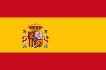
- Population: almost 50 million people (2026)
- Capital: Madrid (city only) with 3.5 million inhabitants
- Name: Reino de España (Kingdom of Spain), short form: España
- Government: Parliamentary Monarchy
- Head of State: King Felipe VI
- Prime minister: Pedro Sánchez
- Languages: Castilian Spanish 74%, Catalan 17%, Galician, Basque
- Religion: 69% Christians
- Currency: 1 Euro = 100 cents
Spain is the fourth largest country on the European continent after Russia, Ukraine and France.
The country is divided in 17 autonomous regions where people have their own regional government.
Cities in Spain
The capital city of Spain is Madrid which is the second largest city of the European Union countries - after Berlin in Germany.
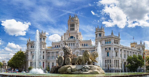 Madrid
The five biggest metropolitan cities in Spain are:
- Madrid with 6.7 million inhabitants
- Barcelona with 5.6 million inhabitants
- Valencia with more than 835,000 inhabitants
- Sevilla with about 700,000 inhabitants
- Zaragoza with more than 600,000 inhabitants
Most of the population (80%) live in urban centres and along the coastlines of Spain. Only about 15% of the people in Spain live in rural areas. More than 2 million people live on the Canary Islands and about 1.2 million people live on the Balearic Islands.
Spanish Culture

Spanish is the world's second-most spoken native language. Castilian Spanish is the official language and spoken in all regions.
Regional languages are Galician, Catalan or Basque.
|
Spain is known for its flamenco dance. In Andalusia, in many towns and villages people dance the flamenco for special festivities. |
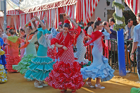 Flamenco dancers Flamenco dancers |
|
The 'Tomatina' festival in the small town of Buñol is the world's biggest food fight, as the people throw tomatoes at each other. The annual battle of tomatoes takes place in August. |
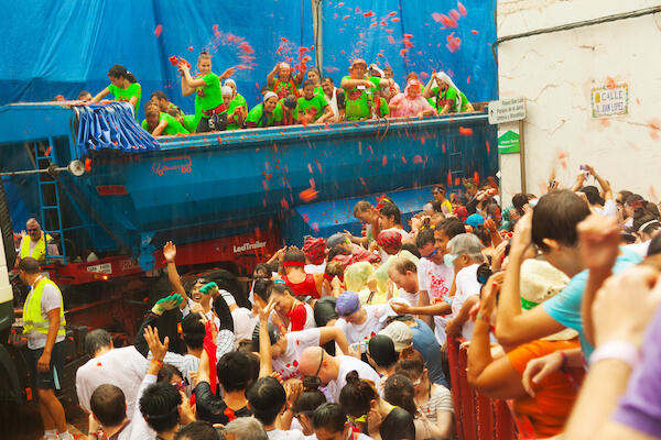 Tomatina - by BearFotos/shutterstock Tomatina - by BearFotos/shutterstock |
|
The people of Tarragona gather every two years for the Concours de Castells Festival in October where participants build tall human towers. |
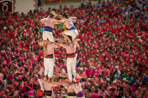 image by David Ortega Baglietto image by David Ortega Baglietto |
|
Often dubbed a national dish, Paella is a traditional rice dish is made with seafood or meat such as rabbit, chicken and snails that originates from Valencia. |
 Paella Paella |
Economy of Spain
The biggest economic sector with about 69% is the service sector which includes banking, insurance, real estate and all services other than farming, forestry, fisheries, mining and manufacturing.
Spain's major economic activities are in the automotive, textile and chemical industry, shipbuilding, agriculture and tourism. Machinery, clothing, cars and petroleum products are the main export products of Spain. ZARA (owned by Inditex) is one of the world's largest fashion brands.
Spain mostly trades with other European countries. The biggest trading partners are France and Germany.
About 10% of the people in Spain are unemployed and the country has the highest unemployment rates among young people with almost 25% in 2026.
The Spanish currency is the EURO. Spain is an active member of the European Union.
Source: INE - last accessed 15 July 2026
Did you know?
 CUPRA - image by Jan Zabrodsky/ Shutterstock.com CUPRA - image by Jan Zabrodsky/ Shutterstock.com |
Tourism
Spain is the most popular tourist destination in Europe. The country attracts more than 100 million visitors every year. Most of the tourist arrivals come from the UK, France and Germany.
Did you know?
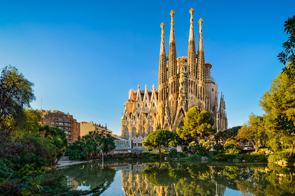 Sagrada Familia in Barcelona - image by Mapix Sagrada Familia in Barcelona - image by Mapix |
Agriculture
Spain is the world's leading olive oil producer and produces around 40-50% of the world's olive oil. It produces more than 1 million tonnes of olive oil per year in a good harvest year, however, this varies with weather conditions and drought.
The main region for olive oil production is Andalusia, which is the world's largest olive oil-producing region. Spain is also known to have more olive groves than any other country in the world.
Citrus fruit peel, nuts and melons are also among the top agricultural products of Spain.
Geography of Spain
FAQs
Where is Spain?
Spain is in south-western Europe on a piece of land called the Iberian Peninsula. Spain shares borders with Portugal, France, Andorra, and the UK (Gibraltar).
What is Spain's largest island?
Spain's largest island is Mallorca which is part of the Balearic Islands in the Mediterranean Sea.
What is the Meseta Central?
The Meseta Central is a huge flat plateau that covers most of Spain's interior. This plateau sits about 660 metres above sea level and as such is higher than most of England!
What is the highest mountain in Spain?
The highest point in Spain is Mount Teide on the Canary Island of Tenerife. The dormant volcano is 3,715 m/ 12,188 ft high and the third tallest volcano on an ocean island in the world!
The highest mountain on the Spanish mainland is Pico de Mulhacén in the Sierra Nevada.
What are Spain's most important rivers?
Spain has around 1,800 rivers of which the five biggest are the Ebro, the Tagus, the Guadalquivir, the Guadiana, and the Duero. Most rivers in Spain begin on the slopes of the Meseta and flow towards the Atlantic Ocean or Mediterranean Sea.
Why is Spain so good at growing olive oil and oranges?
Andalusia is Spain's largest and most important farming region. It is located in the country's south and has hot, dry summers and mild winters. These are perfect conditions for olive trees, which don't like cold or waterlogged soil.
Valencia on the east coast has a Mediterranean climate with long sunshine hours and mild winters. This is ideal for growing oranges and other citrus fruit.
There are rivers in both regions that provide irrigation water for the crops.
What is special about the Strait of Gibraltar?
The Strait of Gibraltar is a narrow channel that connects the Atlantic Ocean to the Mediterranean Sea. It is only 14.3 km/ 8.9 miles wide at its narrowest point.
The strait separates Spain from Morocco and as such Europe from Africa. This is one of the busiest shipping lanes in the world. More than 300 container ships pass through the Strait of Gibraltar every day!
Geography of Spain
Superlatives - Cheat Sheet
|
Spain Geo Superlatives
|
Popular Pages
 |
 |
 |
 |
Geography of Spain
Resources
- Spanish Statistical Office. "Economy." INE. Last accessed 15 July 2026
- Christian López. "Liquid Gold? Not for Spanish olive growers struggling to survive". El Pais. 22 July 2019. Last accessed 15 July 2026
- Spain Tourism Official. "Geography and Landscape." spain.info Last accessed 15 July 2026
- European Commission. "Clean Energy for EU islands." EU. Last accessed 15 July 2026
- Barcelona Tourism Management. "Barcelona recorded 26.1 million visitors and €14.041 billion in 2025" Ajuntament.Barcelona.cat. Last accessed 15 July 2026
Images on Geography of Spain Facts for Kids: shutterstock, sxc.hu, wikicommons and own images.
Please contact us to share your info about Spain and expand this Geography of Spain Facts section. Your support is much appreciated. Contact us here for any collaborations, additions or corrections.
Enjoy learning more great Geography of Spain Facts soon!
Return from Geography of Spain to KidsWorldTravelGuide Homepage
Competition
2026
Recent Articles


-
Facts about Tuvalu for Kids: Geography, People and Wildlife
Sep 11, 26 07:15 AM
Explore our facts about Tuvalu and learn about the Polynesian island nation and its geography, people, economy, culture and animals - Worksheets included -
Animals in Norway for Kids: Wildlife Facts
Sep 03, 26 10:50 AM
Animals in Norway explained: meet reindeer, moose, polar bears, whales and puffins, with habitat facts and a short quiz for class. -
Norway Facts for Kids: Fjords, Vikings and Reindeer
Sep 01, 26 09:01 AM
Learn Norway Facts about the land of the Nobel Prize, the Vikings, reindeers, trolls and other attractions
***
More about Countries in Europe
Fun Facts
Fun Games
Other Spanish speaking countries








Like what you read?

|
Would you like a link to share the information with your friends, fans and readers? Simply use the html code below. Copy and paste onto your website, blog or Facebook page: <a href="https://www.kids-world-travel-guide.com/geography-of-spain.html">Kids World Travel Guide: Geography of Spain for Kids</a> Thank You for spreading the word:-) |
Like us
Competition 2026